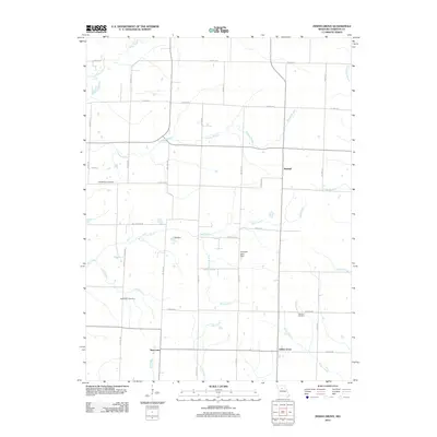
2012 Map of Indian Grove
USGS Topo · Published 2012About this map
Indian Grove and the surrounding rural landscape of Chariton County are defined by a network of waterway branches and local landmarks. The area is intersected by numerous named tributaries, including the winding Yellow Creek in the northwest and Hickory Branch, which cuts across the central region. Small-scale infrastructure like 158 Dam and Huessner Lake Dam indicates local water management for the agricultural community. For those researching family history in Missouri, the map identifies key burial sites such as the Old Mendon Cemetery, Newcomer Cemetery, and the German Cemetery situated along German Rd. Small settlements like Newhall and Newcomer are linked by a grid of county roads, such as Co Hwy-118 and Co Hwy-218, reflecting the established rural settlement patterns of the early 21st century.
Find a feature on this map
39 named features on this map. Tap any name to fly to it.
Don’t see what you’re looking for? This feature index may not catch every label — zoom into the map to look around manually.
Map Details
Editions of this 2012 Indian Grove Map
This is the sole edition of this map. No revisions or reprints were ever made.
Other maps of this area

1890 · Glasgow
USGS Topo · 1:125,000

1890 · Marshall
USGS Topo · 1:125,000

1892 · Marshall
USGS Topo · 1:125,000

1901 · Marshall
USGS Topo · 1:125,000

1949 · Mendon
USGS Topo · 1:24,000

1949 · Indian Grove
USGS Topo · 1:24,000

1949 · Sumner
USGS Topo · 1:24,000

1949 · Rothville
USGS Topo · 1:24,000

1950 · Sumner
USGS Topo · 1:24,000

1950 · Rothville
USGS Topo · 1:24,000