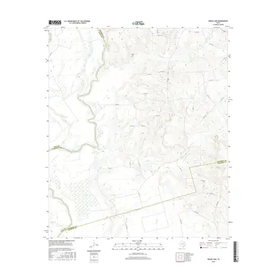
2016 Map of Indian Lake
USGS Topo · Published 2016About this map
The Trinity River winds through a landscape of oxbow lakes and wetlands along the boundaries of Anderson, Leon, and Houston counties. This riverine environment is marked by distinctive water bodies such as Indian Lake, Spring Lake, and the provocatively named Criminal Lake. The terrain transitions from these low-lying bottomlands into higher ground dissected by numerous drainages, including Manson Cr, Box Cr, and Cedar Br.
Find a feature on this map
44 named features on this map. Tap any name to fly to it.
Don’t see what you’re looking for? This feature index may not catch every label — zoom into the map to look around manually.
Map Details
Editions of this 2016 Indian Lake Map
This is the sole edition of this map. No revisions or reprints were ever made.
Other maps of this area

1951 · Elkhart
USGS Topo · 1:62,500

1953 · Palestine
USGS Topo · 1:250,000

1957 · Palestine
USGS Topo · 1:250,000

1964 · Long Lake
USGS Topo · 1:24,000

1964 · Oakwood
USGS Topo · 1:24,000

1964 · Lake Leon
USGS Topo · 1:24,000

1964 · Hays Spring
USGS Topo · 1:24,000

1964 · Stanmire Lake
USGS Topo · 1:24,000

1981 · Palestine
USGS Topo · 1:100,000
1982 · Indian Lake
USGS Topo · 1:24,000