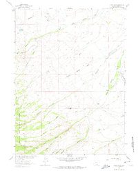
1961 Map of Indian Rocks
USGS Topo · Published 1974About this map
The high plains and ranching country of southern Wyoming come into sharp focus in this mid-century survey, defined by the intricate water management systems essential to the region. Numerous irrigation networks, including Haines Ditch, Trapp Ditch, and Cherokee Ditch, crisscross the terrain to support livestock operations. Settlement is sparse and centered on established family holdings such as Bartlett Ranch and Berger Ranch in the north, while the southern portion of the sheet is dominated by the Medicine Bow National Forest. The map captures a landscape where every drainage and spring is named and utilized, from Methodist Creek to the southern Heather Creek. Prominent landmarks like the Indian Rocks stand out against the topographical contours, providing clear reference points for those tracking historic land use and land ownership in Carbon County.
Find a feature on this map
40 named features on this map. Tap any name to fly to it.
Don’t see what you’re looking for? This feature index may not catch every label — zoom into the map to look around manually.
Map Details
Editions of this 1961 Indian Rocks Map
3 editions found
Other maps of this area

1932 · Savery
USGS Topo · 1:96,000

1939 · Saratoga
USGS Topo · 1:125,000

1940 · Savery
USGS Topo · 1:125,000

1954 · Rawlins
USGS Topo · 1:250,000

1958 · Rawlins
USGS Topo · 1:250,000

1961 · Red Mountain
USGS Topo · 1:24,000

1961 · Bridger Peak
USGS Topo · 1:24,000

1961 · Encampment
USGS Topo · 1:24,000

1961 · Jack Creek Reservoir
USGS Topo · 1:24,000
1961 · Saratoga
USGS Topo · 1:24,000