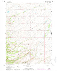
1961 Map of Indian Rocks
USGS Topo · Published 1984About this map
Indian Rocks rises as a prominent landmark in this high-altitude landscape where the headwaters of the Missouri River Basin originate. The terrain is characterized by a complex network of irrigation ditches, including the Cherokee Ditch, Trapp Ditch, and Newport Ditch, signaling the vital role of water management for the high-country ranching operations scattered across the quadrangle. Settlements are defined by private holdings such as Bartlett Ranch and Walliser Ranch, alongside the V Swanson Ranch and C Swanson Ranch. To the south and west, the map transitions into the protected timberlands of the Medicine Bow National Forest, where drainages like Chippewa Creek and Beaver Creek flow through deeper canyons. The presence of Dunkard Road and various unnamed trails suggests the early transit routes used by ranchers and foresters alike.
Find a feature on this map
42 named features on this map. Tap any name to fly to it.
Don’t see what you’re looking for? This feature index may not catch every label — zoom into the map to look around manually.
Map Details
Editions of this 1961 Indian Rocks Map
3 editions found
Other maps of this area

1932 · Savery
USGS Topo · 1:96,000

1939 · Saratoga
USGS Topo · 1:125,000

1940 · Savery
USGS Topo · 1:125,000

1954 · Rawlins
USGS Topo · 1:250,000

1958 · Rawlins
USGS Topo · 1:250,000

1961 · Red Mountain
USGS Topo · 1:24,000

1961 · Bridger Peak
USGS Topo · 1:24,000

1961 · Encampment
USGS Topo · 1:24,000

1961 · Jack Creek Reservoir
USGS Topo · 1:24,000
1961 · Saratoga
USGS Topo · 1:24,000