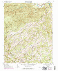
1968 Map of Indian Valley
USGS Topo · Published 1978About this map
Indian Valley serves as a central hub in this late 1960s landscape, positioned where the drainage of Indian Creek and the West Fork Indian Creek meet. The map reveals a community defined by its dispersed rural structure, with several country churches including Indian Valley Ch, Union Ch, and Indian Creek Ch anchoring the social geography. Education is centered at the Indian Valley Sch, while the presence of a Quarry and a Gravel Pit indicates local small-scale industry.
Find a feature on this map
34 named features on this map. Tap any name to fly to it.
Don’t see what you’re looking for? This feature index may not catch every label — zoom into the map to look around manually.
Map Details
Editions of this 1968 Indian Valley Map
3 editions found
Other maps of this area

1889 · Hillsville
USGS Topo · 1:125,000

1890 · Dublin
USGS Topo · 1:125,000

1890 · Christiansburg
USGS Topo · 1:125,000

1891 · Dublin
USGS Topo · 1:125,000

1892 · Hillsville
USGS Topo · 1:125,000

1896 · Hillsville
USGS Topo · 1:125,000

1932 · Blacksburg
USGS Topo · 1:48,000

1937 · Blacksburg
USGS Topo · 1:62,500

1950 · Radford
USGS Topo · 1:62,500

1953 · Winston-Salem
USGS Topo · 1:250,000