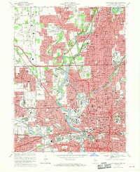
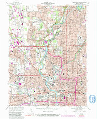
1967 Map of Indianapolis West
USGS Topo · Published 1969About this map
The White River and the Indianapolis Water Company Canal anchor this detailed mid-century view of the city's west side and the diverse neighborhoods of Washington Township and Wayne Township. The landscape is dominated by massive institutional footprints, from the sprawling Crown Hill Cemetery and Butler University in the north to the industrial and healthcare hubs near the city center. This period captures the city's infrastructure at a peak of density, showing the Penn Central and Monon rail lines serving the urban core alongside the emerging Interstate 65. Significant medical and social history is grounded in the presence of the Indiana University Medical Center and Central State Hospital, while the legendary Indianapolis Motor Speedway defines the character of the Speedway enclave to the west.
Find a feature on this map
146 named features on this map. Tap any name to fly to it.
Don’t see what you’re looking for? This feature index may not catch every label — zoom into the map to look around manually.
Map Details
Editions of this 1967 Indianapolis West Map
5 editions found
Other maps of this area

1948 · Indianapolis East
USGS Topo · 1:24,000

1948 · Maywood
USGS Topo · 1:24,000

1948 · Beech Grove
USGS Topo · 1:24,000

1948 · Indianapolis West
USGS Topo · 1:24,000

1952 · Fishers
USGS Topo · 1:24,000

1952 · Carmel
USGS Topo · 1:24,000

1953 · Bridgeport
USGS Topo · 1:24,000

1953 · Zionsville
USGS Topo · 1:24,000

1953 · Clermont
USGS Topo · 1:24,000

1953 · Indianapolis
USGS Topo · 1:250,000
Featured Places
- Indianapolis, IN
- Speedway, Indianapolis
- Meridian Hills, Indianapolis
- Rocky Ripple, Indianapolis
- Wynnedale, Indianapolis