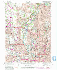
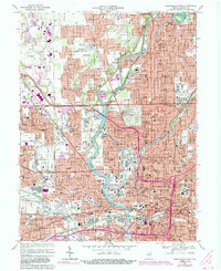
1967 Map of Indianapolis West
USGS Topo · Published 1991About this map
The White River and Fall Creek converge near the heart of the Indiana state capital in this 1960s-era topographical study. The city's landscape is defined by its monumental history, notably at Crown Hill Cemetery, which contains the James Whitcomb Riley Monument and the Grave of President Harrison. The map details an era of significant urban infrastructure, marked by the rising network of interstate interchanges and the sprawling grounds of the State Fairgrounds. To the west, the Indianapolis Motor Speedway and the adjacent town of Speedway illustrate the region's deep racing heritage. The dense street grid of Center township is balanced by institutional campuses like the State School for the Deaf and the Womens Reformatory. This survey captures the capital just as the interstate system began to reshape the old neighborhoods of Indianola and Mt Jackson.
Find a feature on this map
163 named features on this map. Tap any name to fly to it.
Don’t see what you’re looking for? This feature index may not catch every label — zoom into the map to look around manually.
Map Details
Editions of this 1967 Indianapolis West Map
5 editions found
Other maps of this area

1948 · Indianapolis East
USGS Topo · 1:24,000

1948 · Maywood
USGS Topo · 1:24,000

1948 · Beech Grove
USGS Topo · 1:24,000

1948 · Indianapolis West
USGS Topo · 1:24,000

1952 · Fishers
USGS Topo · 1:24,000

1952 · Carmel
USGS Topo · 1:24,000

1953 · Bridgeport
USGS Topo · 1:24,000

1953 · Zionsville
USGS Topo · 1:24,000

1953 · Clermont
USGS Topo · 1:24,000

1953 · Indianapolis
USGS Topo · 1:250,000
Featured Places
- Indianapolis, IN
- Speedway, Indianapolis
- Meridian Hills, Indianapolis
- Rocky Ripple, Indianapolis
- Wynnedale, Indianapolis