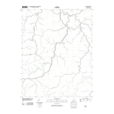
2010 Map of Inez
USGS Topo · Published 2010About this map
The Middle Fork Rockcastle Creek drainage basin defines the landscape of eastern Kentucky in this 2010 study. The community of Inez sits at the northern edge, serving as a focal point for a network of valley settlements including Davella, Debord, and Tomahawk. These small hamlets are connected by a web of narrow mountain roads, such as Davella Rd and Rockhouse Fork Rd, that follow the natural contours of the creek beds.
Find a feature on this map
72 named features on this map. Tap any name to fly to it.
Don’t see what you’re looking for? This feature index may not catch every label — zoom into the map to look around manually.
Map Details
Editions of this 2010 Inez Map
This is the sole edition of this map. No revisions or reprints were ever made.
Other maps of this area

1886 · Prestonsburg
USGS Topo · 1:125,000

1887 · Warfield
USGS Topo · 1:125,000

1891 · Warfield
USGS Topo · 1:125,000

1892 · Prestonsburg
USGS Topo · 1:125,000

1910 · Naugatuck
USGS Topo · 1:48,000

1912 · Naugatuck
USGS Topo · 1:62,500

1914 · Laynesville
USGS Topo · 1:48,000

1914 · Inez
USGS Topo · 1:48,000

1915 · Williamson
USGS Topo · 1:48,000

1915 · Naugatuck
USGS Topo · 1:48,000