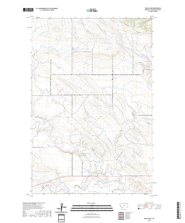
2024 Map of Ingals Dam
USGS Topo · Published 2024About this map
Cat Creek Cem sits as a lonely marker in the center of this Petroleum County landscape, a vital point of reference for genealogists tracing family roots in this expansive ranching country. The terrain is defined by the winding paths of Box Elder Creek and McDonald Creek, which carve through the plains and meet in the southern portion of the sheet. These drainage patterns, including the deep-cut Bull Springs Coulee and Jackson Coulee, dictate the orientation of local roads and the few remaining structures in the area. The map illustrates a contemporary view of these natural boundaries and remote watercourses like Cat Creek and Brush Creek, showing the persistence of the original township and range divisions across the Big Sky landscape.
Find a feature on this map
13 named features on this map. Tap any name to fly to it.
Don’t see what you’re looking for? This feature index may not catch every label — zoom into the map to look around manually.
Map Details
Editions of this 2024 Ingals Dam Map
This is the sole edition of this map. No revisions or reprints were ever made.
Other maps of this area

1954 · Roundup
USGS Topo · 1:250,000

1954 · Lewistown
USGS Topo · 1:250,000

1958 · Roundup
USGS Topo · 1:250,000

1959 · Lewistown
USGS Topo · 1:250,000

1963 · Petrolia Lake
USGS Topo · 1:24,000
1963 · Breed Spring
USGS Topo · 1:24,000
1986 · Cat Creek
USGS Topo · 1:24,000

1986 · Ingals Dam
USGS Topo · 1:24,000

1986 · Winnett North
USGS Topo · 1:24,000
1986 · Tin Can Hill
USGS Topo · 1:24,000