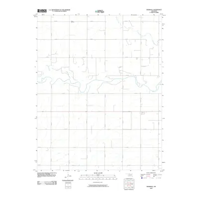
2009 Map of Ingersoll
USGS Topo · Published 2009About this map
The Salt Fork Arkansas River carves a meandering path across this Alfalfa County landscape, defining the central geography of the region. This 2009 survey by the U.S. Geological Survey documents a rural Oklahoma section characterized by a rigid section-line road grid, including routes like E0100 Rd and N2570 Rd. For those researching family history in the area, Keith Cemetery sits in the northern reaches, serving as a significant genealogical anchor. The topography is relatively gentle, with drainage systems like Driftwood Creek feeding into the main river valley. Small-scale infrastructure is noted by local markers such as 1st St, indicating where the grid tightens around established settlement patterns near the river's path.
Find a feature on this map
19 named features on this map. Tap any name to fly to it.
Don’t see what you’re looking for? This feature index may not catch every label — zoom into the map to look around manually.
Map Details
Editions of this 2009 Ingersoll Map
This is the sole edition of this map. No revisions or reprints were ever made.
Other maps of this area

1955 · Woodward
USGS Topo · 1:250,000

1958 · Woodward
USGS Topo · 1:250,000

1968 · Capron
USGS Topo · 1:24,000

1969 · Dacoma
USGS Topo · 1:24,000

1969 · Lambert
USGS Topo · 1:24,000

1969 · Alva SE
USGS Topo · 1:24,000

1969 · Amorita
USGS Topo · 1:24,000

1969 · Burlington
USGS Topo · 1:24,000

1969 · Cherokee North
USGS Topo · 1:24,000

1969 · Ingersoll
USGS Topo · 1:24,000