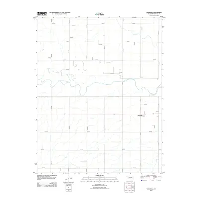
2012 Map of Ingersoll
USGS Topo · Published 2012About this map
Ingersoll occupies the southeastern quadrant of this Alfalfa County survey, situated just north of the junction between 1st St and 4th St. The landscape is dominated by the winding course of the Salt Fork Arkansas River, which cuts across the central portion of the map, carving a wide alluvial valley through the section lines. To the north, Driftwood Cr meanders toward the river, while Cottonwood Cr enters from the south. The area maintains a rigid agricultural grid defined by numerous rural routes such as E0160 Rd and N2590 Rd. Near the northern border, Keith Cem serves as a significant landmark for genealogists and local historians, representing a traditional rural burial ground established well away from the primary settlement. The map provides a clear look at the hydraulic patterns and transport network of the Oklahoma plains in the early 21st century.
Find a feature on this map
37 named features on this map. Tap any name to fly to it.
Don’t see what you’re looking for? This feature index may not catch every label — zoom into the map to look around manually.
Map Details
Editions of this 2012 Ingersoll Map
This is the sole edition of this map. No revisions or reprints were ever made.
Other maps of this area

1955 · Woodward
USGS Topo · 1:250,000

1958 · Woodward
USGS Topo · 1:250,000

1968 · Capron
USGS Topo · 1:24,000

1969 · Dacoma
USGS Topo · 1:24,000

1969 · Lambert
USGS Topo · 1:24,000

1969 · Alva SE
USGS Topo · 1:24,000

1969 · Amorita
USGS Topo · 1:24,000

1969 · Burlington
USGS Topo · 1:24,000

1969 · Cherokee North
USGS Topo · 1:24,000

1969 · Ingersoll
USGS Topo · 1:24,000