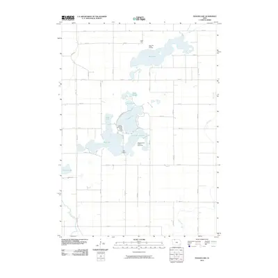
2010 Map of Ingham Lake
USGS Topo · Published 2010About this map
Peterson Point Historic Farmstead anchors this rural landscape, situated on the eastern shore of Ingham Lake. The area is defined by a complex chain of glacial lakes and sloughs, including Swan Lake to the north and High Lake to the south. This network of water is connected by several marshy channels like North Slough, West Slough, and Cunningham Slough, illustrating the post-glacial topography of Palo Alto County.
Find a feature on this map
40 named features on this map. Tap any name to fly to it.
Don’t see what you’re looking for? This feature index may not catch every label — zoom into the map to look around manually.
Map Details
Editions of this 2010 Ingham Lake Map
This is the sole edition of this map. No revisions or reprints were ever made.
Other maps of this area

1954 · Fairmont
USGS Topo · 1:250,000

1958 · Fairmont
USGS Topo · 1:250,000

1972 · Graettinger West
USGS Topo · 1:24,000

1972 · Wallingford
USGS Topo · 1:24,000

1972 · Estherville
USGS Topo · 1:24,000

1980 · Depew
USGS Topo · 1:24,000

1980 · Ringsted
USGS Topo · 1:24,000

1980 · Ingham Lake
USGS Topo · 1:24,000

1980 · Gruver
USGS Topo · 1:24,000

1980 · Graettinger East
USGS Topo · 1:24,000