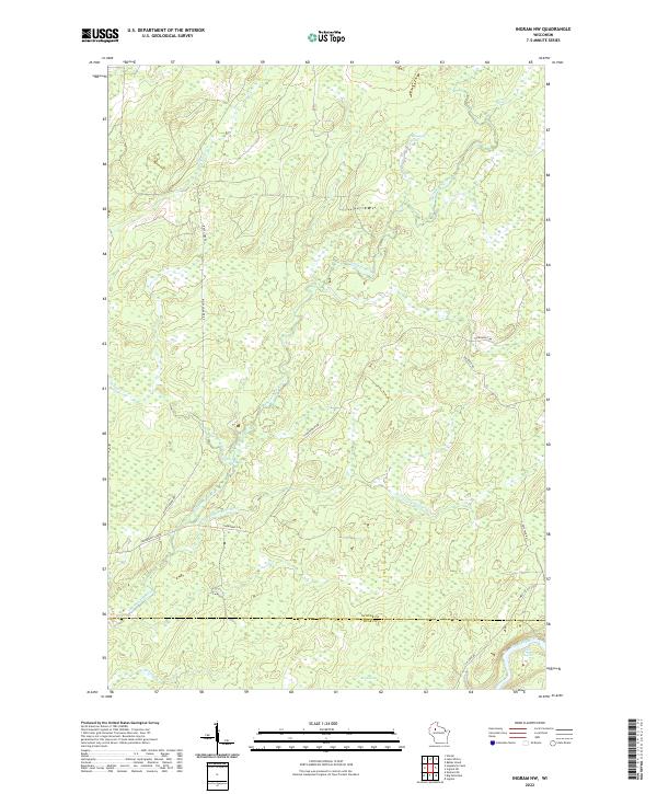
2022 Map of Ingram NW
USGS Topo · Published 2022About this map
The Thornapple River snakes across this northern Wisconsin landscape, defining a region dominated by intricate waterways and marshy lowlands. This survey illustrates the convergence of the Little Thornapple River and Tupper Cr amidst a network of established forestry and utility routes, such as the Thornapple Grade and Bissell Grade. In the southeastern corner, the Flambeau River passes through the Third Cedar Rapids, a notable point of navigation and whitewater on this significant river system. The presence of the Big Swamp and Thornapple Spring highlights the hydrologic complexity of the border between Sawyer and Rusk counties. This modern study provides an exact record of the wetlands and drainage patterns that have shaped land use in the Northwoods for generations.
Find a feature on this map
24 named features on this map. Tap any name to fly to it.
Don’t see what you’re looking for? This feature index may not catch every label — zoom into the map to look around manually.
Map Details
Editions of this 2022 Ingram NW Map
This is the sole edition of this map. No revisions or reprints were ever made.
Other maps of this area

1944 · Exeland
USGS Topo · 1:48,000

1944 · Draper
USGS Topo · 1:48,000

1944 · Radisson
USGS Topo · 1:48,000

1945 · Ingram
USGS Topo · 1:48,000

1947 · Exeland
USGS Topo · 1:48,000

1947 · Ingram
USGS Topo · 1:48,000

1947 · Draper
USGS Topo · 1:48,000

1949 · Radisson
USGS Topo · 1:48,000

1953 · Rice Lake
USGS Topo · 1:250,000

1959 · Rice Lake
USGS Topo · 1:250,000