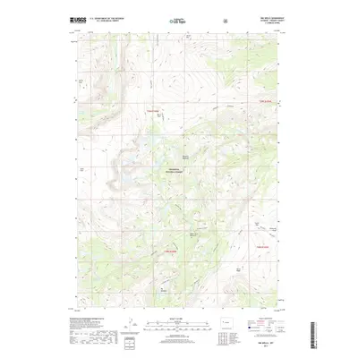
2017 Map of Ink Wells
USGS Topo · Published 2017About this map
Shoshone National Forest contains a complex network of alpine water bodies and high-elevation terrain within this portion of Fremont County. The eponymous Ink Wells are located near Dinwoody Peak and Scenic Pass, serving as a central landmark for the surrounding backcountry. Traditional routes like the Glacier Trail and Old Glacier Trail navigate the steep slopes between Torrey Peak and Arrow Mtn, connecting several named basins. The drainage patterns of Dinwoody Cr and Downs Fork feed a series of glacial lakes, including Double Lake, Florence Lake, and Honeymoon Lake. These features, alongside Big Meadows and Shangrila Meadows, illustrate the high-altitude riparian environments that define the Wind River Range wilderness area preserved on this sheet.
Find a feature on this map
38 named features on this map. Tap any name to fly to it.
Don’t see what you’re looking for? This feature index may not catch every label — zoom into the map to look around manually.
Map Details
Editions of this 2017 Ink Wells Map
This is the sole edition of this map. No revisions or reprints were ever made.
Other maps of this area
1909 · Fremont Peak
USGS Topo · 1:125,000
1952 · Hays Park
USGS Topo · 1:24,000
1952 · Bob Lakes
USGS Topo · 1:24,000
1952 · Blue Holes
USGS Topo · 1:24,000

1955 · Thermopolis
USGS Topo · 1:250,000
1958 · Thermopolis
USGS Topo · 1:250,000
1962 · Thermopolis
USGS Topo · 1:250,000
1968 · Torrey Lake
USGS Topo · 1:24,000
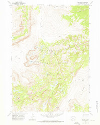
1968 · Ink Wells
USGS Topo · 1:24,000
1968 · Simpson Lake
USGS Topo · 1:24,000