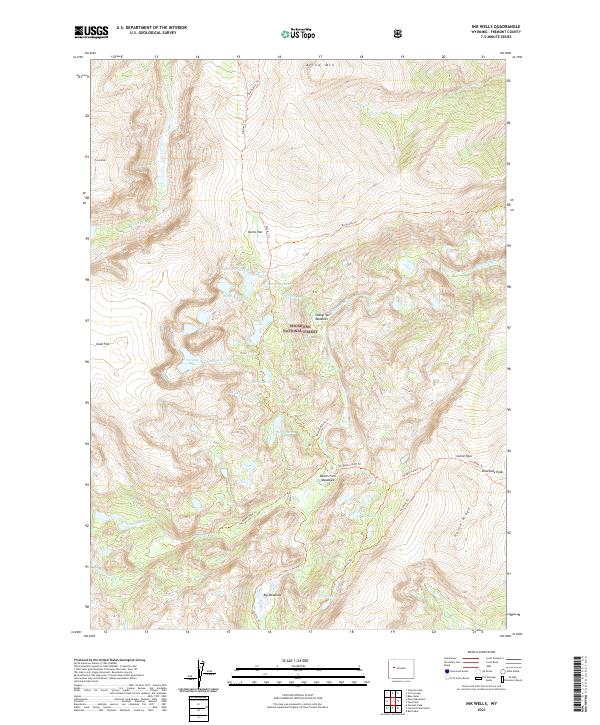
2021 Map of Ink Wells
USGS Topo · Published 2021About this map
Shoshone National Forest defines this high-elevation landscape in Fremont County, dominated by the peaks and drainages of the Wind River Range. The 2021 topography reveals a complex network of glacial features and alpine waterways, including the clustered Ink Wells and the remote Honeymoon Lake. Significant summits such as Dinwoody Peak and Torrey Peak anchor the high ground, connected by long-established backcountry routes like the Glacier Trl and Dinwoody Trl.
Find a feature on this map
39 named features on this map. Tap any name to fly to it.
Don’t see what you’re looking for? This feature index may not catch every label — zoom into the map to look around manually.
Map Details
Editions of this 2021 Ink Wells Map
This is the sole edition of this map. No revisions or reprints were ever made.
Other maps of this area

1909 · Fremont Peak
USGS Topo · 1:125,000

1952 · Hays Park
USGS Topo · 1:24,000

1952 · Bob Lakes
USGS Topo · 1:24,000

1952 · Blue Holes
USGS Topo · 1:24,000

1955 · Thermopolis
USGS Topo · 1:250,000

1958 · Thermopolis
USGS Topo · 1:250,000

1962 · Thermopolis
USGS Topo · 1:250,000
1968 · Torrey Lake
USGS Topo · 1:24,000
1968 · Ink Wells
USGS Topo · 1:24,000
1968 · Simpson Lake
USGS Topo · 1:24,000