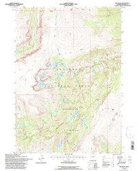
1991 Map of Ink Wells
USGS Topo · Published 1997About this map
Shoshone National Forest contains a complex glacial landscape within the Fitzpatrick Wilderness, where high alpine features like Goat Flat and Horse Ridge overlook a network of high-altitude water bodies. The geography is defined by the flow of Dinwoody Creek and the Downs Fork, which collect runoff from remnants like the Meadows Glacier. Evidence of seasonal land use appears at Williamson Corrals near the northern boundary, while the Glacier Trail provides the primary route through the rugged eastern terrain.
Find a feature on this map
32 named features on this map. Tap any name to fly to it.
Don’t see what you’re looking for? This feature index may not catch every label — zoom into the map to look around manually.
Map Details
Editions of this 1991 Ink Wells Map
This is the sole edition of this map. No revisions or reprints were ever made.
Other maps of this area

1909 · Fremont Peak
USGS Topo · 1:125,000

1952 · Hays Park
USGS Topo · 1:24,000

1952 · Bob Lakes
USGS Topo · 1:24,000

1952 · Blue Holes
USGS Topo · 1:24,000

1955 · Thermopolis
USGS Topo · 1:250,000

1958 · Thermopolis
USGS Topo · 1:250,000

1962 · Thermopolis
USGS Topo · 1:250,000
1968 · Torrey Lake
USGS Topo · 1:24,000
1968 · Ink Wells
USGS Topo · 1:24,000
1968 · Simpson Lake
USGS Topo · 1:24,000