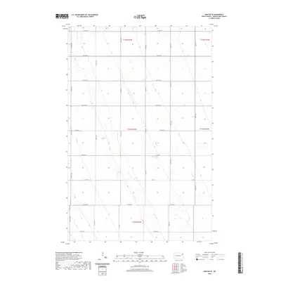
2020 Map of Inkster SE
USGS Topo · Published 2020About this map
The agrarian landscape of Grand Forks County is defined by a rigorous section line grid, documented here by the U.S. Geological Survey in the late 2010s. This portion of the Red River Valley shows a highly organized rural infrastructure, where life and transit revolve around a network of gravel and paved roads such as Co Rd 14 and 37th St Ne. The map reveals the subtle topographic undulations typical of this glaciated plain, with various intermittent drainage patterns crossing the fields between arterial routes like 31st Ave Ne and 23rd Ave Ne. This survey is a clear record of modern land use in North Dakota's wheat and beet country, reflecting the persistent geometry of the Public Land Survey System through its townships and ranges.
Find a feature on this map
20 named features on this map. Tap any name to fly to it.
Don’t see what you’re looking for? This feature index may not catch every label — zoom into the map to look around manually.
Map Details
Editions of this 2020 Inkster SE Map
This is the sole edition of this map. No revisions or reprints were ever made.
Other maps of this area

1926 · Ardoch
USGS Topo · 1:62,500

1934 · Emerado
USGS Topo · 1:48,000

1936 · Emerado
USGS Topo · 1:62,500

1936 · Larimore
USGS Topo · 1:62,500

1952 · Grand Forks
USGS Topo · 1:250,000

1952 · Thief River Falls
USGS Topo · 1:250,000

1956 · Thief River Falls
USGS Topo · 1:250,000

1956 · Grand Forks
USGS Topo · 1:250,000

1957 · Thief River Falls
USGS Topo · 1:250,000

1963 · Orr
USGS Topo · 1:24,000