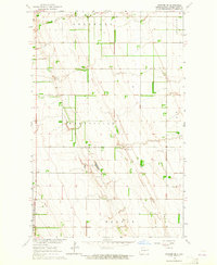
1963 Map of Inkster SE
USGS Topo · Published 1964About this map
The agrarian townships of Wheatfield, Strabane, and Johnstown dominate this 1963 survey of northeastern North Dakota. This landscape is defined by a rigorous grid of section lines and field boundaries, many of which were photogrammetrically confirmed from 1961 aerial photography. A solitary Townhall stands near the center of the sheet, serving as a localized civic anchor for the surrounding farmsteads. The terrain is marked by a series of north-south glacial ridges or beach lines, where numerous Gravel Pits have been established to exploit the underlying geology. These extractive sites, found throughout Hegton and Gilby, represent the primary industrial footprint in an otherwise purely agricultural expanse. The map also includes portions of Elm Grove, showing a meticulously surveyed network of roads and fence lines typical of the Red River Valley’s development in the early 1960s.
Find a feature on this map
9 named features on this map. Tap any name to fly to it.
Don’t see what you’re looking for? This feature index may not catch every label — zoom into the map to look around manually.
Map Details
Editions of this 1963 Inkster SE Map
This is the sole edition of this map. No revisions or reprints were ever made.
Other maps of this area

1926 · Ardoch
USGS Topo · 1:62,500

1934 · Emerado
USGS Topo · 1:48,000

1936 · Emerado
USGS Topo · 1:62,500

1936 · Larimore
USGS Topo · 1:62,500

1952 · Grand Forks
USGS Topo · 1:250,000

1952 · Thief River Falls
USGS Topo · 1:250,000

1956 · Thief River Falls
USGS Topo · 1:250,000

1956 · Grand Forks
USGS Topo · 1:250,000

1957 · Thief River Falls
USGS Topo · 1:250,000

1963 · Orr
USGS Topo · 1:24,000