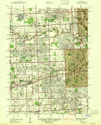
1942 Map of Inkster
USGS Topo · Published 1942About this map
The sprawling Eloise Hospital complex and its associated Eloise Cem anchor the center of this landscape, just before the rapid post-war suburbanization of western Wayne County. Surveyed by A. W. Plushnick and J. H. Taubr, the map captures a transition from agricultural land and early mill sites like Nankin Mills to planned residential developments such as Sherwood Gardens and Rosedale Gardens. The area is defined by its industrial transit corridors, with the Michigan Central RR, Pere Marquette RR, and Wabash RR cutting through the terrain. Evidence of early aviation appears at the National Air Service Airport, while the established settlements of Garden City, Inkster, and Wayne are seen in their pre-1950s configurations. The hydrology of the region is dominated by the branches of the Rouge River, including the Middle Rouge River and Lower Rouge River, which historically powered the local mills.
Find a feature on this map
68 named features on this map. Tap any name to fly to it.
Don’t see what you’re looking for? This feature index may not catch every label — zoom into the map to look around manually.
Map Details
Editions of this 1942 Inkster Map
2 editions found
Other maps of this area

1905 · Wayne
USGS Topo · 1:62,500

1905 · Detroit
USGS Topo · 1:62,500

1906 · Wyandotte
USGS Topo · 1:62,500

1906 · Romulus
USGS Topo · 1:62,500

1912 · Wyandotte
USGS Topo · 1:62,500

1912 · Wayne
USGS Topo · 1:62,500

1918 · Detroit
USGS Topo · 1:62,500

1924 · Detroit
USGS Topo · 1:62,500

1928 · Romulus
USGS Topo · 1:62,500

1929 · Wyandotte
USGS Topo · 1:62,500