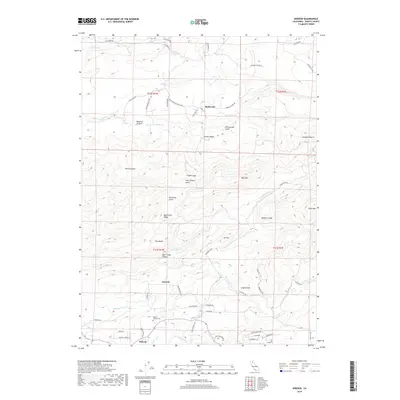
2018 Map of Inwood
USGS Topo · Published 2018About this map
The community of Inwood sits at the base of the Bear Creek Ridge in this Shasta County landscape, where the terrain is deeply carved by water. The transition from the high peaks of Alamine Peak and Blue Mtn down through Bear Creek Canyon and Wagoner Canyon defines the local geography. Settlements like Redwoods and Midway are connected by a network of ranch roads and historic paths such as Ponderosa Way. For those researching family history in the area, the Ogburn Inwood Cemetery serves as a key landmark. The hydrology of the region is prominent, featuring Bear Creek Falls and the confluence of numerous drainages including N Fork Bear Cr, S Fork Bear Cr, and Sheridan Cr. This layout reveals the traditional relationship between early mountain settlements and the essential water resources of the Sierra Nevada foothills.
Find a feature on this map
68 named features on this map. Tap any name to fly to it.
Don’t see what you’re looking for? This feature index may not catch every label — zoom into the map to look around manually.
Map Details
Editions of this 2018 Inwood Map
This is the sole edition of this map. No revisions or reprints were ever made.
Other maps of this area
1886 · Lassen Peak
USGS Topo · 1:250,000
1890 · Red Bluff
USGS Topo · 1:250,000
1892 · Lassen Peak
USGS Topo · 1:250,000
1894 · Lassen Peak
USGS Topo · 1:250,000
1894 · Red Bluff
USGS Topo · 1:250,000
1901 · Redding
USGS Topo · 1:125,000
1935 · Burney
USGS Topo · 1:96,000
1935 · Paynes Creek
USGS Topo · 1:96,000
1939 · Burney
USGS Topo · 1:125,000
1941 · Mineral
USGS Topo · 1:125,000