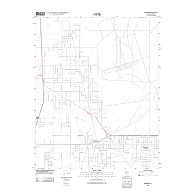
2012 Map of Inyokern
USGS Topo · Published 2012About this map
Inyokern serves as the primary hub of this high-desert landscape in the northeastern Mojave, situated at a key highway junction. The grid-based settlements of China Lake Acres and Indian Wells reflect the residential development of the Indian Wells Valley, while the presence of the Inyokern Airport underscores the region's long-standing connection to aviation and military support. To the west, the terrain rises into Indian Wells Canyon, a stark contrast to the vast, arid floor defined by the seasonal drainage of the Little Dixie Wash. Traces of older crossroads and travel stops appear at Bradys, marking the north-south transit corridor. Local infrastructure is concentrated around the Po in Inyokern, showing the compact center of an otherwise expansive, road-defined desert community during the early twenty-first century.
Find a feature on this map
138 named features on this map. Tap any name to fly to it.
Don’t see what you’re looking for? This feature index may not catch every label — zoom into the map to look around manually.
Map Details
Editions of this 2012 Inyokern Map
This is the sole edition of this map. No revisions or reprints were ever made.
Other maps of this area

1915 · Searles Lake
USGS Topo · 1:250,000

1943 · Inyokern
USGS Topo · 1:62,500

1947 · Trona
USGS Topo · 1:250,000

1948 · Trona
USGS Topo · 1:250,000

1953 · Mountain Springs Canyon
USGS Topo · 1:62,500

1953 · Ridgecrest
USGS Topo · 1:62,500

1953 · Trona
USGS Topo · 1:250,000

1954 · Little Lake
USGS Topo · 1:62,500

1957 · Trona
USGS Topo · 1:250,000

1960 · Trona
USGS Topo · 1:250,000