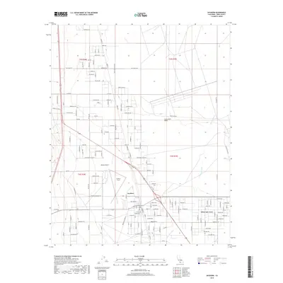
2018 Map of Inyokern
USGS Topo · Published 2018About this map
Indian Wells Valley and the northern reaches of the Mojave Desert define this landscape, where the High Desert terrain meets a grid of residential and ranch roads. The settlement of Inyokern serves as a central hub, flanked by the critical infrastructure of Inyokern Airport and the sprawling community of China Lake Acres to the east. The drainage of Little Dixie Wash snakes across the valley floor, while topographic prominence is found at Sawtooth Peak. Long corridors like Neal Ranch Rd and Leliter Rd mark the transition from open desert to established land holdings. The presence of Snort Access Rd hints at the proximity of specialized local industries or facilities common to this part of Kern County. This recent survey documents the modern intersection of desert wilderness and aviation-related development.
Find a feature on this map
63 named features on this map. Tap any name to fly to it.
Don’t see what you’re looking for? This feature index may not catch every label — zoom into the map to look around manually.
Map Details
Editions of this 2018 Inyokern Map
This is the sole edition of this map. No revisions or reprints were ever made.
Other maps of this area

1915 · Searles Lake
USGS Topo · 1:250,000

1943 · Inyokern
USGS Topo · 1:62,500

1947 · Trona
USGS Topo · 1:250,000

1948 · Trona
USGS Topo · 1:250,000

1953 · Mountain Springs Canyon
USGS Topo · 1:62,500

1953 · Ridgecrest
USGS Topo · 1:62,500

1953 · Trona
USGS Topo · 1:250,000

1954 · Little Lake
USGS Topo · 1:62,500

1957 · Trona
USGS Topo · 1:250,000

1960 · Trona
USGS Topo · 1:250,000