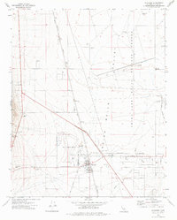
1972 Map of Inyokern
USGS Topo · Published 1975About this map
Indian Wells Valley is defined here by its intersection of desert logistics, military operations, and transit history. The map centers on the community of Inyokern, a hub where the Southern Pacific railroad meets the aviation infrastructure of Kern County Airport No 8. This proximity to the vast China Lake Naval Weapons Center is evident in the presence of the U S Government Railroad and an Old RR Grade, suggesting the shifting transportation needs of the mid-20th century.
Find a feature on this map
32 named features on this map. Tap any name to fly to it.
Don’t see what you’re looking for? This feature index may not catch every label — zoom into the map to look around manually.
Map Details
Editions of this 1972 Inyokern Map
This is the sole edition of this map. No revisions or reprints were ever made.
Other maps of this area

1915 · Searles Lake
USGS Topo · 1:250,000

1943 · Inyokern
USGS Topo · 1:62,500

1947 · Trona
USGS Topo · 1:250,000

1948 · Trona
USGS Topo · 1:250,000

1953 · Mountain Springs Canyon
USGS Topo · 1:62,500

1953 · Ridgecrest
USGS Topo · 1:62,500

1953 · Trona
USGS Topo · 1:250,000

1954 · Little Lake
USGS Topo · 1:62,500

1957 · Trona
USGS Topo · 1:250,000

1960 · Trona
USGS Topo · 1:250,000