2022 Map of Iola
USGS Topo · Published 2022About this map
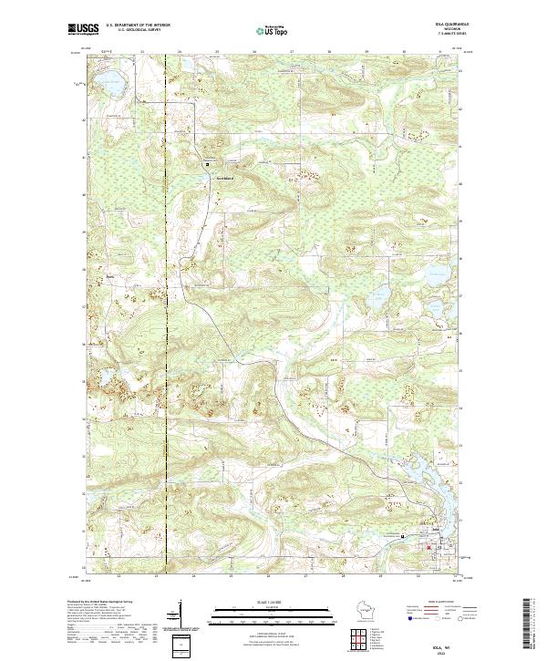
Iola and the surrounding rural townships of Waupaca County are defined by a dense network of glacial lakes and the winding paths of the Little Wolf River. This landscape reflects a long history of communal life centered around the water and land, evident in the numerous burial grounds like the Iola Riverside Community Cem and the Northland Lutheran Cem. Smaller hamlets like Northland and Peru appear as quiet junctions amidst the rolling terrain of Central Wisconsin, while the survey captures the transition between Portage Co and Waupaca Co along its western edge. To the south, the South Branch Little Wolf River meanders toward the village center, passing through a countryside dotted with family-named routes and localized landmarks like Bubsberg Pond and Lake Helen. The map provides a detailed record of local roads and natural drainage patterns, from Flume Cr in the north to the wetlands surrounding Mud Lake on the eastern boundary.
Find a feature on this map
93 named features on this map. Tap any name to fly to it.
Don’t see what you’re looking for? This feature index may not catch every label — zoom into the map to look around manually.
Map Details
Editions of this 2022 Iola Map
This is the sole edition of this map. No revisions or reprints were ever made.