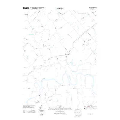
2013 Map of Iona
USGS Topo · Published 2013About this map
White River oxbows and floodplains dominate this part of Knox County, where the river's winding course creates a landscape of seasonal wetlands and distinctive water bodies. Small rural clusters like Iona and Ridgeville are positioned on slightly higher ground, connected by a network of county roads that navigate the complex hydrology of the area. Significant drainage features like Upper River Deshee and Williams Ditch illustrate the long-term efforts to manage the wet prairie and river bottomlands for agricultural use.
Find a feature on this map
77 named features on this map. Tap any name to fly to it.
Don’t see what you’re looking for? This feature index may not catch every label — zoom into the map to look around manually.
Map Details
Editions of this 2013 Iona Map
This is the sole edition of this map. No revisions or reprints were ever made.
Other maps of this area

1901 · Princeton
USGS Topo · 1:62,500

1902 · Ditney
USGS Topo · 1:125,000

1903 · Petersburg
USGS Topo · 1:62,500

1903 · Princeton
USGS Topo · 1:62,500

1903 · Patoka
USGS Topo · 1:125,000

1915 · Vincennes
USGS Topo · 1:62,500

1942 · Fritchton
USGS Topo · 1:24,000

1944 · Fritchton
USGS Topo · 1:24,000

1944 · Monroe City
USGS Topo · 1:24,000

1944 · Wheatland
USGS Topo · 1:24,000