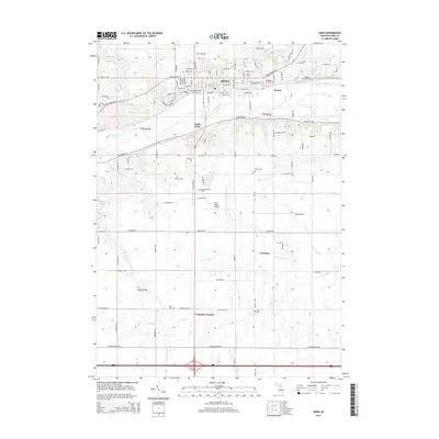
2014 Map of Ionia
USGS Topo · Published 2014About this map
The Grand River carves through the heart of this central Michigan landscape, defining the development of Ionia and its surrounding townships. Settlement patterns here are deeply rooted in the river valley, with neighborhoods like South Ionia and the open flats of Prairie showing a transition from dense street grids to broader agricultural reaches. Genealogists will find a wealth of local data points, including prominent burial grounds such as Oakhill Cem, Mt Olivet Catholic Cem, and Highland Park Cem.
Find a feature on this map
115 named features on this map. Tap any name to fly to it.
Don’t see what you’re looking for? This feature index may not catch every label — zoom into the map to look around manually.
Map Details
Editions of this 2014 Ionia Map
This is the sole edition of this map. No revisions or reprints were ever made.
Other maps of this area

1916 · Ionia
USGS Topo · 1:62,500

1918 · Ionia
USGS Topo · 1:62,500

1943 · Ionia
USGS Topo · 1:62,500

1945 · Portland
USGS Topo · 1:62,500

1954 · Midland
USGS Topo · 1:250,000

1958 · Midland
USGS Topo · 1:250,000

1958 · Grand Rapids
USGS Topo · 1:250,000

1959 · Midland
USGS Topo · 1:250,000

1961 · Grand Rapids
USGS Topo · 1:250,000

1962 · Grand Rapids
USGS Topo · 1:250,000