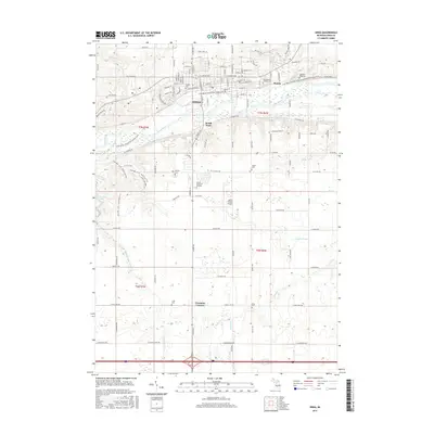
2017 Map of Ionia
USGS Topo · Published 2017About this map
Grand River defines the central topography of this mid-Michigan landscape, anchoring the city of Ionia and its neighboring settlements of South Ionia and Prairie. This 2017 study shows a modern geography shaped by a mix of municipal development, aviation via the Ionia County Airport, and an extensive recreational trail network. The repurposing of older infrastructure is evident in the Fred Meijer Grand River Valley Trail, which follows the historic path of the railway corridor through the river valley.
Find a feature on this map
119 named features on this map. Tap any name to fly to it.
Don’t see what you’re looking for? This feature index may not catch every label — zoom into the map to look around manually.
Map Details
Editions of this 2017 Ionia Map
This is the sole edition of this map. No revisions or reprints were ever made.
Other maps of this area

1916 · Ionia
USGS Topo · 1:62,500

1918 · Ionia
USGS Topo · 1:62,500

1943 · Ionia
USGS Topo · 1:62,500

1945 · Portland
USGS Topo · 1:62,500

1954 · Midland
USGS Topo · 1:250,000

1958 · Midland
USGS Topo · 1:250,000

1958 · Grand Rapids
USGS Topo · 1:250,000

1959 · Midland
USGS Topo · 1:250,000

1961 · Grand Rapids
USGS Topo · 1:250,000

1962 · Grand Rapids
USGS Topo · 1:250,000