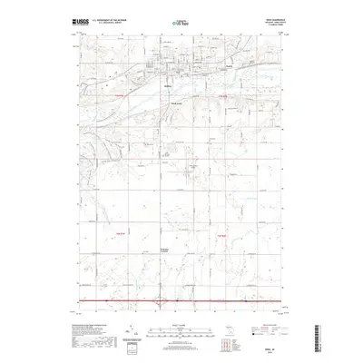
2019 Map of Ionia
USGS Topo · Published 2019About this map
The Grand River serves as the central artery for this Ionia County landscape, dividing the urban center of Ionia from the agricultural reaches of South Ionia and Tremaine Corners. The 2019 survey documents a region defined by its municipal institutions and recreation, notably featuring the Ionia County Courthouse and the expansive western tracts of Ionia State Park. For local history and genealogy, the map provides precise locations for a dense concentration of burial grounds, including the Mount Olivet Catholic Cem, Highland Park Cem, and Oakhill Cem north of the river.
Find a feature on this map
114 named features on this map. Tap any name to fly to it.
Don’t see what you’re looking for? This feature index may not catch every label — zoom into the map to look around manually.
Map Details
Editions of this 2019 Ionia Map
This is the sole edition of this map. No revisions or reprints were ever made.
Other maps of this area

1916 · Ionia
USGS Topo · 1:62,500

1918 · Ionia
USGS Topo · 1:62,500

1943 · Ionia
USGS Topo · 1:62,500

1945 · Portland
USGS Topo · 1:62,500

1954 · Midland
USGS Topo · 1:250,000

1958 · Midland
USGS Topo · 1:250,000

1958 · Grand Rapids
USGS Topo · 1:250,000

1959 · Midland
USGS Topo · 1:250,000

1961 · Grand Rapids
USGS Topo · 1:250,000

1962 · Grand Rapids
USGS Topo · 1:250,000