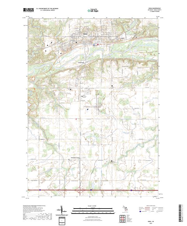
2023 Map of Ionia
USGS Topo · Published 2023About this map
The Grand River carves a central path through this western Michigan landscape, anchoring the city of Ionia and its counterpart, South Ionia. The city's civic identity is established by the Ionia County Courthouse and its historic core, while the surrounding area is defined by a significant concentration of family and community burial grounds, including Oakhill Cem, Highland Park Cem, and Balcom Cem. Modern recreational and transit developments have reshaped the old river corridors, most notably with the Fred Meijer Grand River Valley Trail and the nearby Ionia State Park. To the south, the terrain transitions into a more rural agricultural grid marked by smaller crossroads such as Tremain Corners and the winding courses of Sessions Creek and Libhart Creek. This documentation captures the area's mix of municipal infrastructure, like the Ionia County Airport, and the enduring rural cemetery network that dots the countryside.
Find a feature on this map
79 named features on this map. Tap any name to fly to it.
Don’t see what you’re looking for? This feature index may not catch every label — zoom into the map to look around manually.
Map Details
Editions of this 2023 Ionia Map
This is the sole edition of this map. No revisions or reprints were ever made.
Other maps of this area

1916 · Ionia
USGS Topo · 1:62,500

1918 · Ionia
USGS Topo · 1:62,500

1943 · Ionia
USGS Topo · 1:62,500

1945 · Portland
USGS Topo · 1:62,500

1954 · Midland
USGS Topo · 1:250,000

1958 · Midland
USGS Topo · 1:250,000

1958 · Grand Rapids
USGS Topo · 1:250,000

1959 · Midland
USGS Topo · 1:250,000

1961 · Grand Rapids
USGS Topo · 1:250,000

1962 · Grand Rapids
USGS Topo · 1:250,000