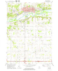
1978 Map of Ionia
USGS Topo · Published 1979About this map
The Grand River corridor anchors this study of Ionia County, highlighting the significant institutional footprint of the late 1970s. The northern bank is dominated by the city of Ionia, where the Ionia State Reformatory, Michigan Training Facility, and Ionia State Hospital represent a concentrated complex of state services and infrastructure. Beyond the urban core, the landscape transitions into a mix of river bottomland and agricultural plateaus, punctuated by rural junctions like Tremain Corners and Ferguson Corners.
Find a feature on this map
83 named features on this map. Tap any name to fly to it.
Don’t see what you’re looking for? This feature index may not catch every label — zoom into the map to look around manually.
Map Details
Editions of this 1978 Ionia Map
This is the sole edition of this map. No revisions or reprints were ever made.
Other maps of this area

1916 · Ionia
USGS Topo · 1:62,500

1918 · Ionia
USGS Topo · 1:62,500

1943 · Ionia
USGS Topo · 1:62,500

1945 · Portland
USGS Topo · 1:62,500

1954 · Midland
USGS Topo · 1:250,000

1958 · Midland
USGS Topo · 1:250,000

1958 · Grand Rapids
USGS Topo · 1:250,000

1959 · Midland
USGS Topo · 1:250,000

1961 · Grand Rapids
USGS Topo · 1:250,000

1962 · Grand Rapids
USGS Topo · 1:250,000