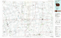
1984 Map of Iowa Falls
USGS Topo · Published 1985About this map
Iowa Falls serves as the focal point for this north-central Iowa survey, which details a landscape defined by its agricultural grid and rich network of wildlife conservation areas. The Chicago and North Western railroad provides the primary industrial spine, connecting historic grain and trade hubs like Belmond, Hampton, and Sheffield. This era shows a dedicated commitment to land management, visible in the numerous conservation sites such as the Big Wall Lake State Wildlife Management Area and the Ingebretson Memorial Grove Nature Study Area. Waterways like the Boone River and South Fork Iowa River meander through the prairie, supporting local recreation at spots like Beeds Lake State Park and Lake Cornelia County Park. The map captures several small rail-stop settlements, including Galt, Olaf, and Faulkner, many of which remain vital links in the region's rural genealogy.
Find a feature on this map
85 named features on this map. Tap any name to fly to it.
Don’t see what you’re looking for? This feature index may not catch every label — zoom into the map to look around manually.
Map Details
Editions of this 1984 Iowa Falls Map
2 editions found
Other maps of this area

1923 · Lehigh
USGS Topo · 1:62,500

1923 · Fort Dodge
USGS Topo · 1:62,500

1954 · Fairmont
USGS Topo · 1:250,000

1954 · Mason City
USGS Topo · 1:250,000

1954 · Waterloo
USGS Topo · 1:250,000

1954 · Fort Dodge
USGS Topo · 1:250,000

1955 · Waterloo
USGS Topo · 1:250,000

1957 · Fort Dodge
USGS Topo · 1:250,000

1957 · Mason City
USGS Topo · 1:250,000

1958 · Mason City
USGS Topo · 1:250,000