1984 Map of Iowa Falls
USGS Topo · Published 1993About this map
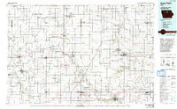
The Iowa River and its varied tributaries, including the Boone River and Maynes Creek, carve through the agricultural heartland of North Central Iowa in this late-twentieth-century study. This map reveals a landscape defined by water management and conservation, featuring numerous protected zones like the Big Wall Lake State Wildlife Management Area and Elm Lake State Wildlife Management Area. These areas, alongside Lake Cornelia County Park, illustrate the regional commitment to preserving wildlife habitats amidst the surrounding townships of Belmond, Grimes, and Richland.
Find a feature on this map
157 named features on this map. Tap any name to fly to it.
Don’t see what you’re looking for? This feature index may not catch every label — zoom into the map to look around manually.
Map Details
Editions of this 1984 Iowa Falls Map
2 editions found

Historical Maps of Iowa Falls Through Time
1 maps found