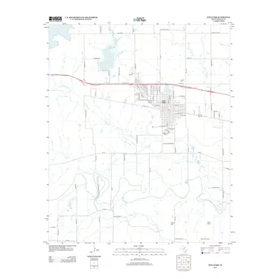
2013 Map of Iowa Park
USGS Topo · Published 2013About this map
Iowa Park serves as the central hub of this North Texas landscape, where the residential street grid gives way to a complex system of hydraulic management and agricultural infrastructure. The topography is defined by the winding course of the Wichita River and its tributaries, including Buffalo Cr and Stevens Cr. Local water resources are heavily managed through features like the N Fork Buffalo Cr Reservoir, Lake Iowa Park, and Gordon Lake, reflecting the region's reliance on irrigation and water storage. To the south, the terrain rises toward landmarks such as Temple Hill and Bare Butte, while the P M Lateral and numerous rural routes like Bacon Switch Rd and FM-367 illustrate the transition from the town center to the surrounding ranching and farming operations. The presence of Highland Cem and Cactus Hill Airport provides important points of reference for local historians and genealogists.
Find a feature on this map
83 named features on this map. Tap any name to fly to it.
Don’t see what you’re looking for? This feature index may not catch every label — zoom into the map to look around manually.
Map Details
Editions of this 2013 Iowa Park Map
This is the sole edition of this map. No revisions or reprints were ever made.
Other maps of this area

1915 · Clara
USGS Topo · 1:24,000

1915 · Barwise School
USGS Topo · 1:24,000

1915 · Burkburnett
USGS Topo · 1:24,000

1916 · Iowa Park
USGS Topo · 1:24,000

1916 · Fowlkes
USGS Topo · 1:24,000

1918 · Buckburnett
USGS Topo · 1:31,680

1918 · Barwise School
USGS Topo · 1:31,680

1918 · Clara
USGS Topo · 1:31,680

1918 · Iowa Park
USGS Topo · 1:31,680

1919 · Fowlkes
USGS Topo · 1:31,680