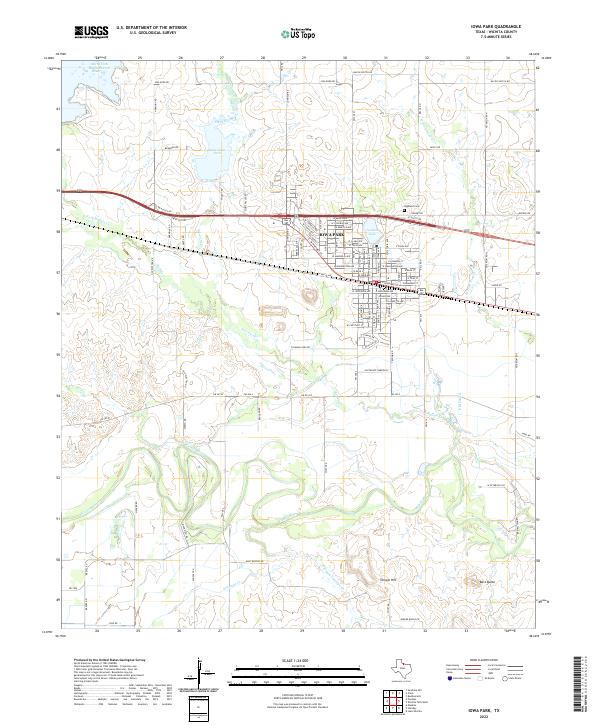
2022 Map of Iowa Park
USGS Topo · Published 2022About this map
Iowa Park serves as the focal point of this North Texas landscape, where the prairie transitions into a complex network of managed waterways and agricultural infrastructure. The town's grid is bounded by notable water features including Gordon Lake to the east and the expansive Lake Iowa Park to the northwest, which is fed by Stevens Creek. This area illustrates the critical role of water management in Wichita County, evidenced by the North Fork Buffalo Creek Reservoir and the P M Lateral canal system.
Find a feature on this map
61 named features on this map. Tap any name to fly to it.
Don’t see what you’re looking for? This feature index may not catch every label — zoom into the map to look around manually.
Map Details
Editions of this 2022 Iowa Park Map
This is the sole edition of this map. No revisions or reprints were ever made.
Other maps of this area

1915 · Clara
USGS Topo · 1:24,000

1915 · Barwise School
USGS Topo · 1:24,000

1915 · Burkburnett
USGS Topo · 1:24,000

1916 · Iowa Park
USGS Topo · 1:24,000

1916 · Fowlkes
USGS Topo · 1:24,000

1918 · Buckburnett
USGS Topo · 1:31,680

1918 · Barwise School
USGS Topo · 1:31,680

1918 · Clara
USGS Topo · 1:31,680

1918 · Iowa Park
USGS Topo · 1:31,680

1919 · Fowlkes
USGS Topo · 1:31,680