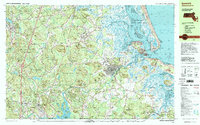
1997 Map of Ipswich
USGS Topo · Published 1999About this map
Ipswich and the surrounding Essex County marshlands are defined by a complex network of coastal waterways including the Plum Island Sound, Ipswich River, and the Parker River. This late-twentieth-century landscape preserves significant tracts of conservation land, notably the Parker River National Wildlife Refuge and Willowdale State Forest. The map documents the persistent layout of historic colonial settlements like Rowley and Topsfield, while highlighting institutional landmarks such as the Governor Dummer Academy and the USAF Geophysics Lab Radio Observatory.
Find a feature on this map
144 named features on this map. Tap any name to fly to it.
Don’t see what you’re looking for? This feature index may not catch every label — zoom into the map to look around manually.
Map Details
Editions of this 1997 Ipswich Map
This is the sole edition of this map. No revisions or reprints were ever made.
Other maps of this area

1886 · Gloucester
USGS Topo · 1:62,500

1886 · Lawrence
USGS Topo · 1:62,500

1888 · Newburyport
USGS Topo · 1:62,500

1888 · Haverhill
USGS Topo · 1:62,500

1888 · Gloucester
USGS Topo · 1:62,500

1888 · Lawrence
USGS Topo · 1:62,500

1888 · Salem
USGS Topo · 1:62,500

1890 · Haverhill
USGS Topo · 1:62,500

1890 · Newburyport
USGS Topo · 1:62,500

1893 · Salem
USGS Topo · 1:62,500