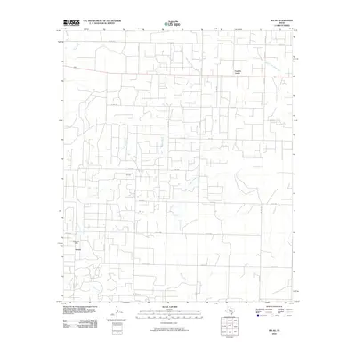
2010 Map of Ira NE
USGS Topo · Published 2010About this map
The Diamond M Oil Field dominates this West Texas landscape, illustrating the extensive infrastructure of the energy industry in Scurry County. A dense network of county roads, including Co RD 3101 and Co RD 3104, connects numerous well sites and collection points across the plains. In the southwest, the settlement of Knapp serves as a local hub, anchored by the Knapp Post Office near the intersection of FM 1610 and Co RD 3164. The terrain is defined by a series of intermittent drainages, such as Bluff Creek, Chimney Creek, and Bull Creek, which carve subtle paths through the industrial and agricultural sections of the quadrangle. In the northeast, Franklin Center sits along the roadway, while South Fork Deep Creek and Moose Creek provide further geographical definition to this petroleum-rich region.
Find a feature on this map
28 named features on this map. Tap any name to fly to it.
Don’t see what you’re looking for? This feature index may not catch every label — zoom into the map to look around manually.
Map Details
Editions of this 2010 Ira NE Map
This is the sole edition of this map. No revisions or reprints were ever made.
Other maps of this area

1951 · Ira SW
USGS Topo · 1:24,000

1951 · Ira
USGS Topo · 1:24,000

1951 · Dunn
USGS Topo · 1:24,000

1951 · Ira NW
USGS Topo · 1:24,000

1952 · Snyder
USGS Topo · 1:24,000

1952 · Ira NE
USGS Topo · 1:24,000

1954 · Dermott
USGS Topo · 1:24,000

1954 · Brand
USGS Topo · 1:24,000

1954 · Big Spring
USGS Topo · 1:250,000

1958 · Big Spring
USGS Topo · 1:250,000