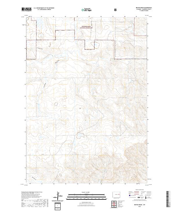
2021 Map of Ireton Draw
USGS Topo · Published 2021About this map
Thunder Basin National Grassland dominates the northern reaches of this high plains landscape in Converse County. The terrain is defined by a dendritic network of seasonal drainages, or draws, which have historically dictated the movement of livestock and the placement of ranching infrastructure. Principal among these are Ireton Draw, Shelden Draw, and Reeves Draw, which converge to shape the local topography. While largely devoid of permanent settlements, the presence of Esau Rd in the southern sections provides a clear trace of the rural road network used for land management and ranch access. Smaller watercourses like Dry Cr and Mikes Draw further detail the complex hydrology of this grassland environment, which remains a critical area for public land use and grazing at the time of this 2021 survey.
Find a feature on this map
13 named features on this map. Tap any name to fly to it.
Don’t see what you’re looking for? This feature index may not catch every label — zoom into the map to look around manually.
Map Details
Editions of this 2021 Ireton Draw Map
This is the sole edition of this map. No revisions or reprints were ever made.
Other maps of this area

1955 · Newcastle
USGS Topo · 1:250,000

1958 · Newcastle
USGS Topo · 1:250,000

1959 · Bill
USGS Topo · 1:62,500

1959 · Betty Reservoir
USGS Topo · 1:62,500

1970 · Bill 4 SE
USGS Topo · 1:24,000

1970 · Bill 4 NW
USGS Topo · 1:24,000
1970 · Bill 4 SW
USGS Topo · 1:24,000

1970 · Bill 4 NE
USGS Topo · 1:24,000

1971 · Esau Spring
USGS Topo · 1:24,000

1971 · Tin Can Lake
USGS Topo · 1:24,000