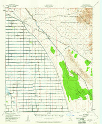
1940 Map of Iris
USGS Topo · Published 1961About this map
The Southern Pacific railroad corridor serves as the backbone of this arid Imperial County landscape, connecting isolated sidings like Iris and Flowing Well Siding during the early 1940s. To the west, the desert gives way to a highly organized network of irrigation canals and lateral roads, where settlements such as Wiest and Munyon support local agriculture. The Mulberry Sch stands as a focal point for the rural community near the Alamo River and Gieselmann Lake.
Find a feature on this map
28 named features on this map. Tap any name to fly to it.
Don’t see what you’re looking for? This feature index may not catch every label — zoom into the map to look around manually.
Map Details
Editions of this 1940 Iris Map
4 editions found
Other maps of this area

1907 · Holtville
USGS Topo · 1:125,000

1915 · El Centro
USGS Topo · 1:125,000

1940 · Brawley
USGS Topo · 1:62,500

1940 · Iris
USGS Topo · 1:62,500

1940 · Frink
USGS Topo · 1:62,500

1940 · Iris Pass
USGS Topo · 1:62,500

1940 · Alamorio
USGS Topo · 1:62,500

1942 · El Centro
USGS Topo · 1:250,000

1943 · Brawley
USGS Topo · 1:62,500

1944 · Calipatria
USGS Topo · 1:62,500