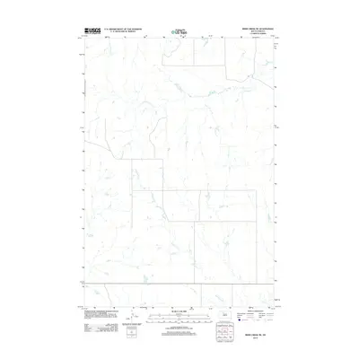
2012 Map of Irish Creek NE
USGS Topo · Published 2012About this map
Firesteel Cr meanders across this rural expanse of the Rock Creek District in Corson County, shaping a landscape defined by its prairie drainages. The map reveals a sparsely settled territory where the hydrological network of Red Earth Cr and Cottonwood Cr provides the primary geographic orientation. This 2012 USGS survey reflects the contemporary topographic character of north-central South Dakota, where sections are divided by a rectilinear grid of local roads and state routes. The lack of named settlements or civic institutions on the sheet emphasizes the expansive, agricultural nature of the region during the early 21st century. Researchers can trace the subtle elevation changes and the specific reaches of these three primary creek systems as they interact with the section lines and boundary roads of the Standing Rock area.
Find a feature on this map
3 named features on this map. Tap any name to fly to it.
Don’t see what you’re looking for? This feature index may not catch every label — zoom into the map to look around manually.
Map Details
Editions of this 2012 Irish Creek NE Map
This is the sole edition of this map. No revisions or reprints were ever made.
Other maps of this area

1953 · McIntosh
USGS Topo · 1:250,000

1956 · Black Horse SW
USGS Topo · 1:24,000

1956 · Cottonwood Creek SE
USGS Topo · 1:24,000

1956 · Cottonwood Creek SW
USGS Topo · 1:24,000

1958 · McIntosh
USGS Topo · 1:250,000

1978 · Isabel SW
USGS Topo · 1:24,000

1978 · Isabel
USGS Topo · 1:24,000

1980 · McIntosh
USGS Topo · 1:100,000

1982 · Irish Creek SW
USGS Topo · 1:24,000
1982 · Irish Creek NW
USGS Topo · 1:24,000