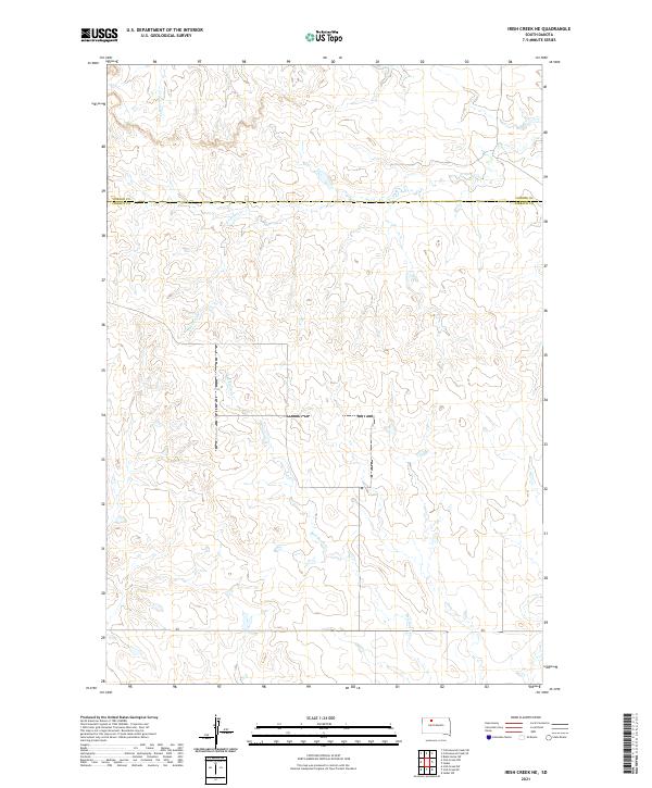
2021 Map of Irish Creek NE
USGS Topo · Published 2021About this map
Firesteel Creek meanders through this portion of the northern Great Plains, cutting a winding path across the boundary between Corson and Ziebach counties. The landscape is defined by its drainage systems, including the headwaters of Red Earth Creek and the northward flow of Cottonwood Creek. This 2021 survey reflects the enduring section-line grid of the Public Land Survey System, revealing how the geography of South Dakota remains anchored to the legal townships of t17n r21e and t18n r21e. While the map is notably sparse of modern settlements, the topographic contours and watercourses provide a detailed look at the unpopulated prairie as it appeared in the early 21st century.
Find a feature on this map
10 named features on this map. Tap any name to fly to it.
Don’t see what you’re looking for? This feature index may not catch every label — zoom into the map to look around manually.
Map Details
Editions of this 2021 Irish Creek NE Map
This is the sole edition of this map. No revisions or reprints were ever made.
Other maps of this area

1953 · McIntosh
USGS Topo · 1:250,000

1956 · Black Horse SW
USGS Topo · 1:24,000

1956 · Cottonwood Creek SE
USGS Topo · 1:24,000

1956 · Cottonwood Creek SW
USGS Topo · 1:24,000

1958 · McIntosh
USGS Topo · 1:250,000

1978 · Isabel SW
USGS Topo · 1:24,000

1978 · Isabel
USGS Topo · 1:24,000

1980 · McIntosh
USGS Topo · 1:100,000

1982 · Irish Creek SW
USGS Topo · 1:24,000
1982 · Irish Creek NW
USGS Topo · 1:24,000