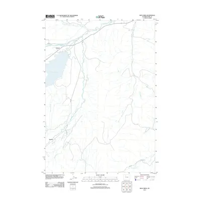
2012 Map of Iron Creek
USGS Topo · Published 2012About this map
The Greybull River and Wood River converge in this high-desert ranching landscape of Park County, defining a region where water management is central to the local economy. Man-made infrastructure like the Pappapau Ditch and Only Chance Ditch divert precious flow to sustain the arid terrain, while the Lower Sunshine Reservoir provides a critical anchor for the area's hydrology. Small outposts and agricultural hubs such as Sunshine and Dumbell are scattered near these watercourses, connected by gravel routes like Road 4DT. To the southeast, Renner's Ranch sits near the drainage of Gooseberry Cr, illustrating the long-standing reliance on seasonal creek beds like Iron Cr and Little Buffalo Cr for livestock and land use in the Wyoming interior.
Find a feature on this map
16 named features on this map. Tap any name to fly to it.
Don’t see what you’re looking for? This feature index may not catch every label — zoom into the map to look around manually.
Map Details
Editions of this 2012 Iron Creek Map
This is the sole edition of this map. No revisions or reprints were ever made.
Other maps of this area

1904 · Kirwin
USGS Topo · 1:125,000

1906 · Kirwin
USGS Topo · 1:125,000

1911 · Meeteetse
USGS Topo · 1:62,500

1913 · Meeteetse
USGS Topo · 1:62,500

1955 · Cody
USGS Topo · 1:250,000

1955 · Thermopolis
USGS Topo · 1:250,000

1956 · Soapy Dale Peak
USGS Topo · 1:24,000

1956 · Adam Weiss Peak
USGS Topo · 1:24,000

1957 · Sunshine Reservoir
USGS Topo · 1:62,500

1958 · Cody
USGS Topo · 1:250,000