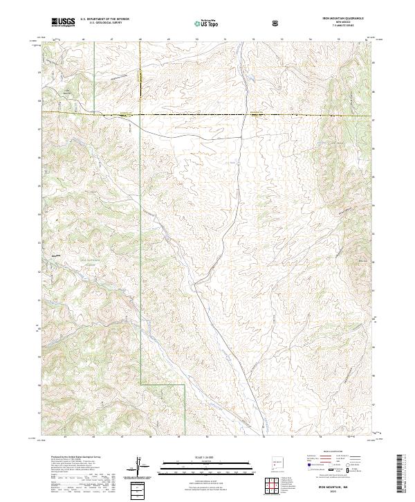
2023 Map of Iron Mountain
USGS Topo · Published 2023About this map
Grafton sits along the western edge of this territory, where the foothills meet the Gila National Forest. The landscape is defined by the complex convergence of three counties—Catron, Socorro, and Sierra—marked by high-altitude features like Iron Mtn, Little Red Hill, and Reilly Peak. A dense network of drainages including Poverty Creek, Turkey Creek, and Bear Creek carves through the terrain, illustrating the hydrologic character of this remote mountain region. These watercourses are flanked by secondary routes such as Buster Creek Rd and Escondrio Rd, which provide access through the deep canyons and draws. The presence of Piñon Spring and several tanks like C C Tank highlights the vital importance of water management for any activity in this arid high-country environment.
Find a feature on this map
32 named features on this map. Tap any name to fly to it.
Don’t see what you’re looking for? This feature index may not catch every label — zoom into the map to look around manually.
Map Details
Editions of this 2023 Iron Mountain Map
This is the sole edition of this map. No revisions or reprints were ever made.
Other maps of this area

1949 · Lookout Mountain
USGS Topo · 1:62,500

1954 · Tularosa
USGS Topo · 1:250,000

1958 · Tularosa
USGS Topo · 1:250,000

1964 · Montoya Butte
USGS Topo · 1:24,000

1965 · Winston
USGS Topo · 1:24,000

1965 · Iron Mountain
USGS Topo · 1:24,000

1965 · Jaralosa Mountain
USGS Topo · 1:24,000
1965 · Chise
USGS Topo · 1:24,000

1965 · Wahoo Peak
USGS Topo · 1:24,000

1979 · Truth or Consequences
USGS Topo · 1:100,000