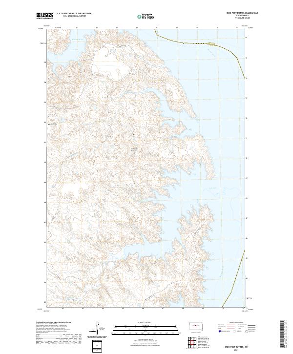
2021 Map of Iron Post Buttes
USGS Topo · Published 2021About this map
Lake Oahe dominates this part of central South Dakota, where the reservoir floods the historic path of the Missouri River along the border of Stanley and Sully counties. The landscape rising west of the water is defined by the high, broken terrain of the Iron Post Buttes, a series of prominent formations that overlook the drainage basins of Mission Cr and Sunil Cr. This area retains its rural, open character, centered on the small settlement of Mission Ridge.
Find a feature on this map
18 named features on this map. Tap any name to fly to it.
Don’t see what you’re looking for? This feature index may not catch every label — zoom into the map to look around manually.
Map Details
Editions of this 2021 Iron Post Buttes Map
This is the sole edition of this map. No revisions or reprints were ever made.
Other maps of this area

1954 · Pierre
USGS Topo · 1:250,000

1958 · Pierre
USGS Topo · 1:250,000

1969 · Rousseau Creek
USGS Topo · 1:24,000

1969 · No Heart Creek SE
USGS Topo · 1:24,000

1969 · No Heart Creek SW
USGS Topo · 1:24,000
1973 · Iron Post Buttes SE
USGS Topo · 1:24,000

1973 · Iron Post Buttes SW
USGS Topo · 1:24,000

1973 · Iron Post Buttes
USGS Topo · 1:24,000
1973 · Mail Shack Creek
USGS Topo · 1:24,000

1982 · Mission Ridge
USGS Topo · 1:24,000