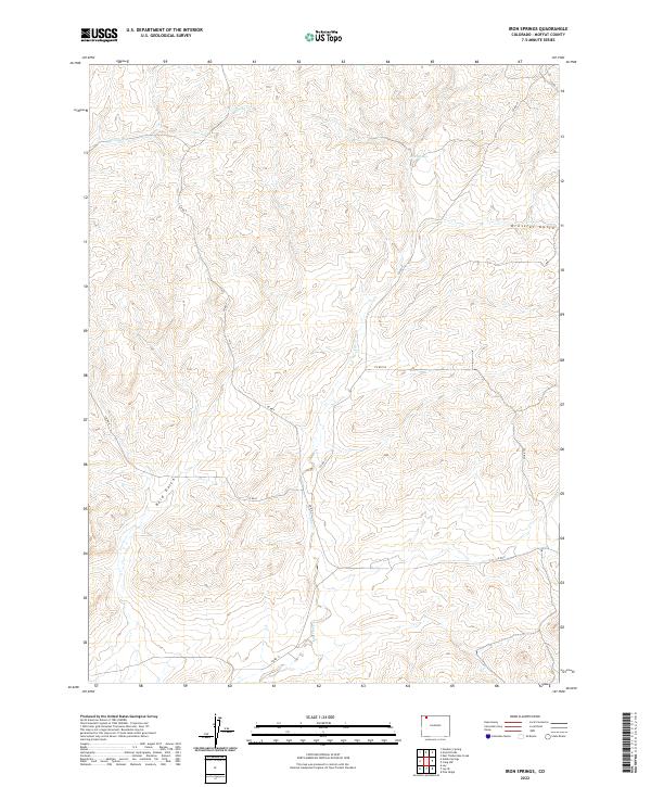
2022 Map of Iron Springs
USGS Topo · Published 2022About this map
Iron Springs and the drainage of Lay Creek define this high-altitude landscape in Moffat County, where the terrain is carved by seasonal watercourses and intermittent springs. The map documents a sparsely populated region of northwestern Colorado, characterized by significant land divisions such as t9n r93w and t9n r92w. Geographic features like Bord Gulch and Dressler Gulch indicate the complex erosion patterns common to the area's high desert environment. While largely devoid of dense settlements, the presence of various county roads, including Co RD 17 and Co RD 7, suggests a landscape organized for ranching and resource management. These routes follow the natural contours of the land, navigating between peaks and along creek beds like Spring Cr. This survey provides a clear view of the contemporary rural infrastructure and natural hydrology that continues to shape the region.
Find a feature on this map
15 named features on this map. Tap any name to fly to it.
Don’t see what you’re looking for? This feature index may not catch every label — zoom into the map to look around manually.
Map Details
Editions of this 2022 Iron Springs Map
This is the sole edition of this map. No revisions or reprints were ever made.
Other maps of this area

1916 · Craig
USGS Topo · 1:125,000

1954 · Craig
USGS Topo · 1:250,000

1957 · Craig
USGS Topo · 1:250,000

1958 · Craig
USGS Topo · 1:250,000

1960 · Craig
USGS Topo · 1:250,000

1962 · Craig
USGS Topo · 1:250,000

1964 · Craig
USGS Topo · 1:250,000

1965 · Craig
USGS Topo · 1:250,000
1969 · Adobe Springs
USGS Topo · 1:24,000
1969 · Great Divide
USGS Topo · 1:24,000