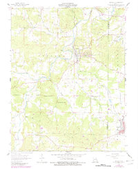
2021 Map of Irondale
USGS Topo · Published 2021About this map
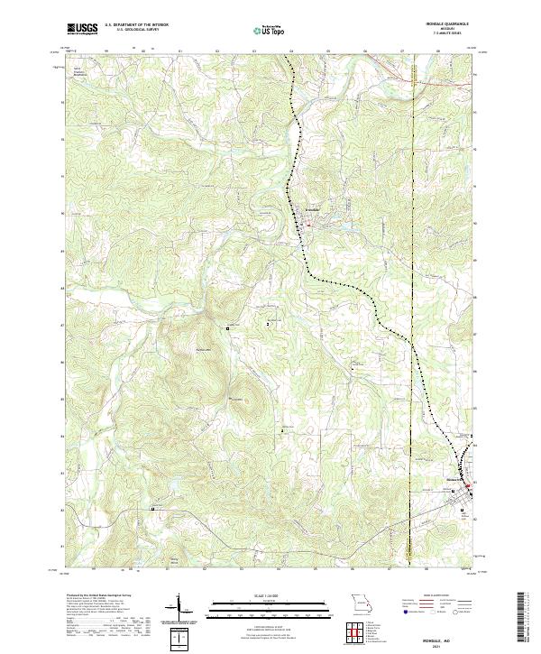
The Big River winds through the hills of Washington and St. Francois Counties, defining the landscape between the settlements of Irondale and Bismarck. This area of the Saint Francois Mountains is characterized by its numerous small family and community burial grounds, including Hughes Cem, Wallen Cem, and Hickory Grove Cem, providing significant touchpoints for genealogical research. The local topography is marked by prominent elevations like Hughes Mtn and Round Mtn, while water bodies such as Lake Apache, Lake Cherokee, and Hillview Lake suggest a transition toward recreational land use in recent decades. The Up-749 railroad line remains a central feature of the local economy and geography, cutting through the terrain near the eastern edge of the quadrangle. The map also records several city-specific landmarks in the southeast, such as the Bismarck City Cem and the Bismarck Masonic Cem, anchoring the town's history.
Find a feature on this map
101 named features on this map. Tap any name to fly to it.
Don’t see what you’re looking for? This feature index may not catch every label — zoom into the map to look around manually.
Map Details
Editions of this 2021 Irondale Map
This is the sole edition of this map. No revisions or reprints were ever made.
Historical Maps of Bismarck Through Time
5 maps found