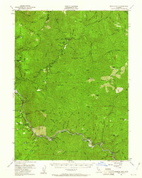
1951 Map of Ironside Mountain
USGS Topo · Published 1961About this map
The Trinity River and New River cut deep canyons through this remote corner of Northern California, defining a landscape of isolated camps and gold-bearing river bars. In the mid-twentieth century, life here revolved around the river crossings and the forest service outposts, with the Denny Guard Sta and Hayden Flat Guard Sta serving as vital hubs. The winding course of the Trinity is dotted with named bars and flats like Schneiders Bar and Sandy Bar, markers of the area’s long mining history.
Find a feature on this map
100 named features on this map. Tap any name to fly to it.
Don’t see what you’re looking for? This feature index may not catch every label — zoom into the map to look around manually.
Map Details
Editions of this 1951 Ironside Mountain Map
4 editions found

Other maps of this area

1909 · Big Bar
USGS Topo · 1:96,000

1914 · Pilot Creek
USGS Topo · 1:62,500

1915 · Big Bar and Vicinity
USGS Topo · 1:250,000

1922 · China Flat
USGS Topo · 1:62,500

1925 · Hoopa
USGS Topo · 1:125,000

1948 · Weed
USGS Topo · 1:250,000

1950 · Weed
USGS Topo · 1:250,000

1951 · Pilot Creek
USGS Topo · 1:62,500

1951 · Hayfork
USGS Topo · 1:62,500

1951 · Helena
USGS Topo · 1:62,500