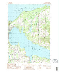
1983 Map of Ironton
USGS Topo · Published 1984About this map
The industrial and maritime character of northern Michigan is evident in this topographic study, where Lake Michigan meets the complex shoreline of Lake Charlevoix. The northern coast is dominated by the Big Rock Powerplant at Big Rock Point, while the interior shows the rural settlement patterns of Hayes and Eveline townships. Key local landmarks like Mount McSauba and Greensky Hill stand above the surrounding glacial terrain, punctuated by smaller water bodies like Susan Lake and Adams Lake.
Find a feature on this map
50 named features on this map. Tap any name to fly to it.
Don’t see what you’re looking for? This feature index may not catch every label — zoom into the map to look around manually.
Map Details
Editions of this 1983 Ironton Map
2 editions found
Other maps of this area

1954 · Central Lake
USGS Topo · 1:62,500

1954 · Charlevoix
USGS Topo · 1:62,500

1955 · Cheboygan
USGS Topo · 1:250,000

1958 · Cheboygan
USGS Topo · 1:250,000

1958 · Bayshore
USGS Topo · 1:62,500

1961 · Boyne City
USGS Topo · 1:62,500

1975 · Boyne City NW
USGS Topo · 1:24,000

1975 · Boyne City NE
USGS Topo · 1:24,000
1983 · Ellsworth
USGS Topo · 1:25,000
1983 · Forest Beach
USGS Topo · 1:25,000