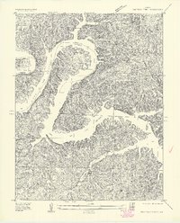
1934 Map of Irontown Ferry
USGS Topo · Published 1934About this map
Lake of the Ozarks dominates this 1934 topographic survey, its winding waters carving a complex series of peninsulas across the Morgan County and Camden County line. The map captures the shoreline during its early years, revealing a landscape where the river's path is still defined by prominent landmarks like Coffman Bend and Thornsberry Bend. The interior terrain is heavily dissected by narrow valleys, including Tree Hollow and Pearson Branch, where small homesteads and rural institutions once clustered.
Find a feature on this map
18 named features on this map. Tap any name to fly to it.
Don’t see what you’re looking for? This feature index may not catch every label — zoom into the map to look around manually.
Map Details
Editions of this 1934 Irontown Ferry Map
2 editions found
Other maps of this area

1887 · Warsaw
USGS Topo · 1:125,000

1888 · Versailles
USGS Topo · 1:125,000

1893 · Versailles
USGS Topo · 1:125,000

1894 · Warsaw
USGS Topo · 1:125,000

1904 · Gravois Mills
USGS Topo · 1:62,500

1934 · Purvis
USGS Topo · 1:24,000

1934 · Irontown Ferry
USGS Topo · 1:24,000

1934 · Green Bay Terrace
USGS Topo · 1:24,000

1935 · Gravois Mills
USGS Topo · 1:24,000

1935 · Barnumton
USGS Topo · 1:24,000