
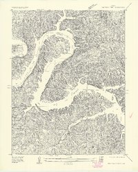
1934 Map of Irontown Ferry
USGS Topo · Published 1934About this map
The newly formed Lake of the Ozarks dominates this 1934 topographic survey, snaking through the river valleys of the Camden and Morgan county line. This map captures the landscape shortly after the completion of Bagnell Dam, showing the vast reach of the reservoir into tributary valleys like Bollinger Creek and Little Niangua River. Along these shorelines, the map preserves the names of early family homesteads and local infrastructure that survived the rising waters, such as the Irontown Ferry crossing and the Old Iron Smelter located near the mouth of a hollow.
Find a feature on this map
36 named features on this map. Tap any name to fly to it.
Don’t see what you’re looking for? This feature index may not catch every label — zoom into the map to look around manually.
Map Details
Editions of this 1934 Irontown Ferry Map
2 editions found
Other maps of this area

1887 · Warsaw
USGS Topo · 1:125,000

1888 · Versailles
USGS Topo · 1:125,000

1893 · Versailles
USGS Topo · 1:125,000

1894 · Warsaw
USGS Topo · 1:125,000

1904 · Gravois Mills
USGS Topo · 1:62,500

1934 · Purvis
USGS Topo · 1:24,000

1934 · Green Bay Terrace
USGS Topo · 1:24,000

1935 · Gravois Mills
USGS Topo · 1:24,000

1935 · Barnumton
USGS Topo · 1:24,000

1935 · Proctor Creek
USGS Topo · 1:24,000