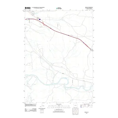
2012 Map of Irvine
USGS Topo · Published 2012About this map
The N Platte River winds through this Converse County landscape, anchoring a corridor of historical transit and settlement south of Douglas. The small community of Irvine sits near the riverbanks, joined by the nearby locality of Foster. This 2012 survey illustrates a modern infrastructure layer superimposed on a traditional ranching and riverine environment, where several named waterways including La Bonte Cr, Wagon Hound Cr, and Sand Cr converge toward the main river channel. Transport patterns are defined by the sweep of Orin Way and the local connectivity provided by Irvine Bridge Rd, which links the disparate settlements across the valley floor. In the northwest, the Runden Number 1 Reservoir serves as a notable landmark for water management in this arid high-plains region.
Find a feature on this map
17 named features on this map. Tap any name to fly to it.
Don’t see what you’re looking for? This feature index may not catch every label — zoom into the map to look around manually.
Map Details
Editions of this 2012 Irvine Map
This is the sole edition of this map. No revisions or reprints were ever made.
Other maps of this area

1949 · Irvine
USGS Topo · 1:24,000

1949 · Poison Lake
USGS Topo · 1:24,000

1949 · Cedar Hill
USGS Topo · 1:24,000

1949 · Douglas
USGS Topo · 1:24,000

1949 · Dilts Ranch
USGS Topo · 1:24,000

1949 · Chalk Buttes
USGS Topo · 1:24,000

1949 · Orin
USGS Topo · 1:24,000

1949 · Antelope Creek
USGS Topo · 1:24,000

1950 · Poison Lake
USGS Topo · 1:24,000

1950 · Douglas
USGS Topo · 1:24,000